
South Africa safari maps
South Africa safari maps for practical trip planning
Understand the relationship between safari regions, gateway cities, Kruger gates and camps, domestic travel and practical route choices. These original maps are planning aids, not live navigation tools.
Choose the map that answers your route question
Use the national maps for broad trip structure, then move to the Kruger, Greater Kruger, Addo or KwaZulu-Natal maps for destination context. Confirm operational information with the responsible park, reserve, lodge, airline or transport provider before travel.
Safari planning atlas
South Africa Safari Regions and Gateways
A national orientation map connecting the main arrival cities with South Africa's major safari regions.
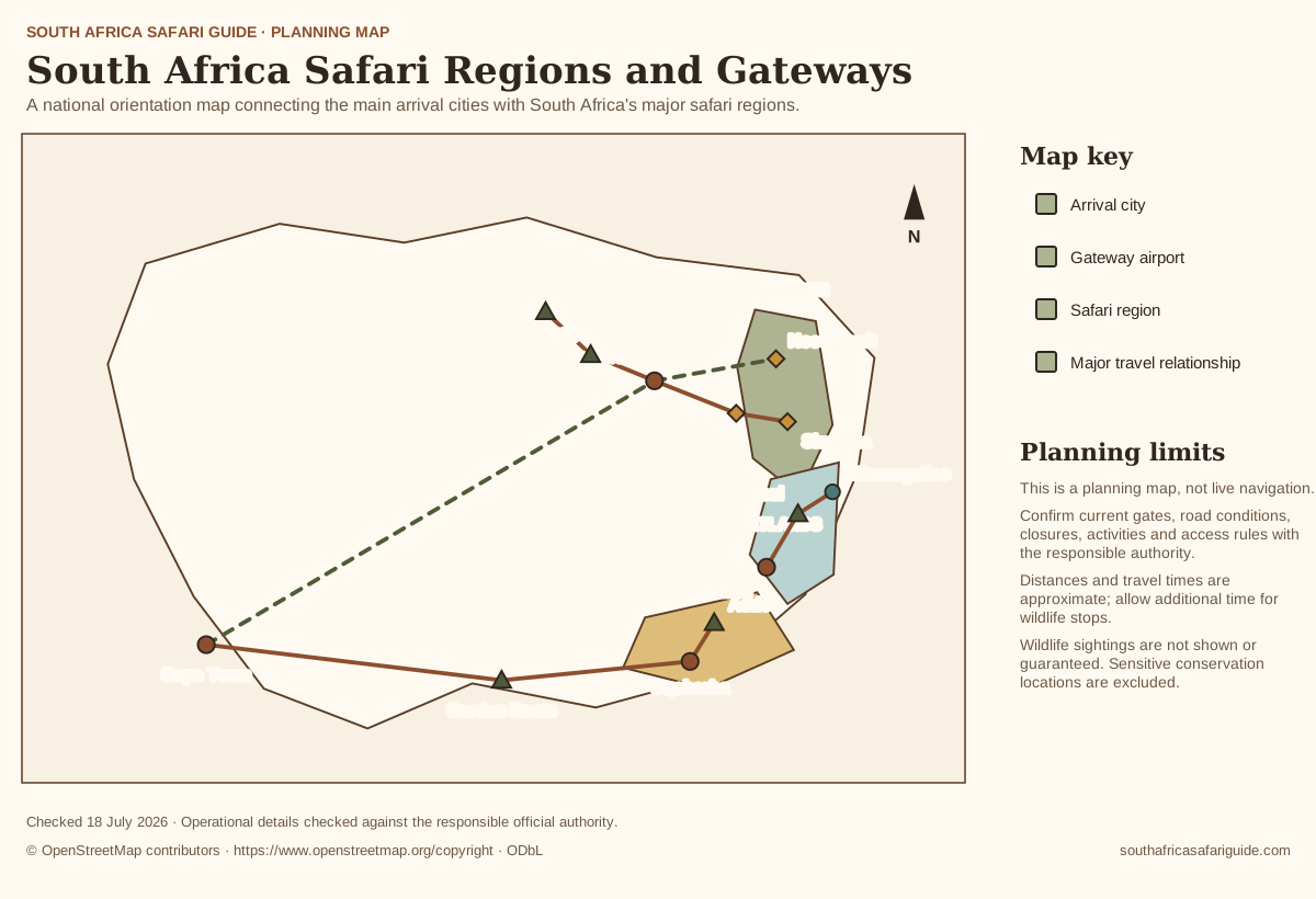
Map in words
- Cape Town sits in the southwest and connects by domestic flight to Johannesburg, Gqeberha and Lowveld safari gateways.
- Johannesburg is the principal inland gateway for Pilanesberg, Madikwe and onward travel to Kruger and Greater Kruger.
- Durban connects with Hluhluwe iMfolozi and the iSimangaliso wetland and coastal route.
- Gqeberha is the gateway for Addo and wider Eastern Cape safari planning, with the Garden Route extending west.
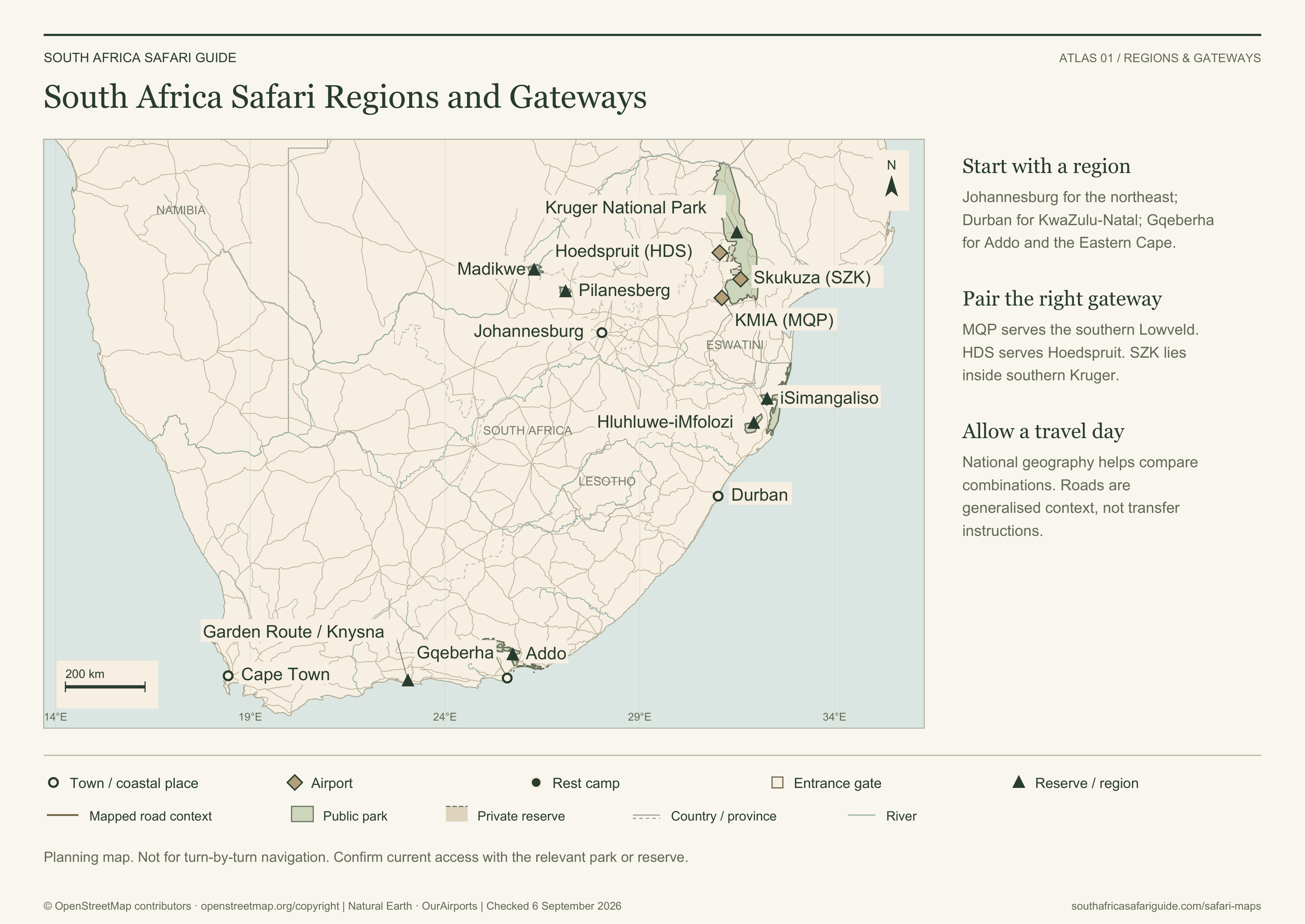
Geography: © OpenStreetMap contributors (ODbL); Natural Earth and OurAirports (public domain). Download source data.
Geographic sources checked . Generalised planning context; confirm current access before travelling.
Map sources and access references
- SANParks Kruger National Park — Current park overview and principal public camp context.
- SANParks Addo access — Official access and gateway context.
- iSimangaliso official maps — Official map directory for St Lucia, Sodwana Bay, Kosi Bay and uMkhuze.
- Ezemvelo KZN Wildlife parks — Responsible authority context for KwaZulu-Natal protected areas.
- Natural Earth — Public-domain country, province, river, road and city context.
- OurAirports — Public-domain airport coordinates; symbols do not assert scheduled services.
Safari planning atlas
Kruger Gates, Camps and Gateway Airports
Locate nine public entrance gates, twelve principal rest camps and Lowveld airports, with an enlarged southern Kruger panel.
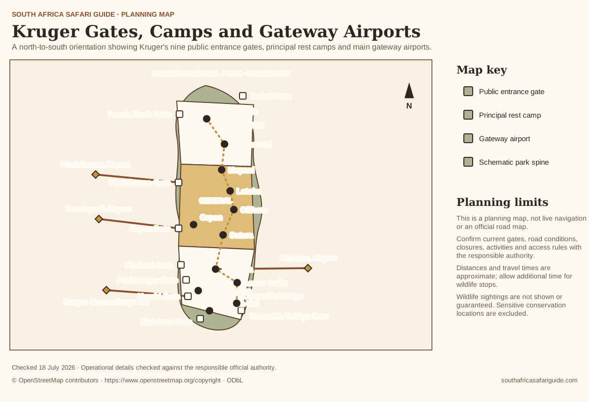
Map in words
- Northern Kruger is oriented around Pafuri and Punda Maria gates, with Punda Maria and Shingwedzi as principal camp anchors.
- Central Kruger includes Phalaborwa and Orpen gates, with Mopani, Letaba, Olifants, Satara and Orpen camps.
- Southern Kruger includes Phabeni, Paul Kruger, Numbi, Malelane and Crocodile Bridge gates, with Skukuza, Pretoriuskop, Lower Sabie, Berg-en-Dal and Crocodile Bridge camps.
- Airports shown are Phalaborwa, Hoedspruit, Skukuza and Kruger Mpumalanga International. Confirm flight services and onward transfers separately.
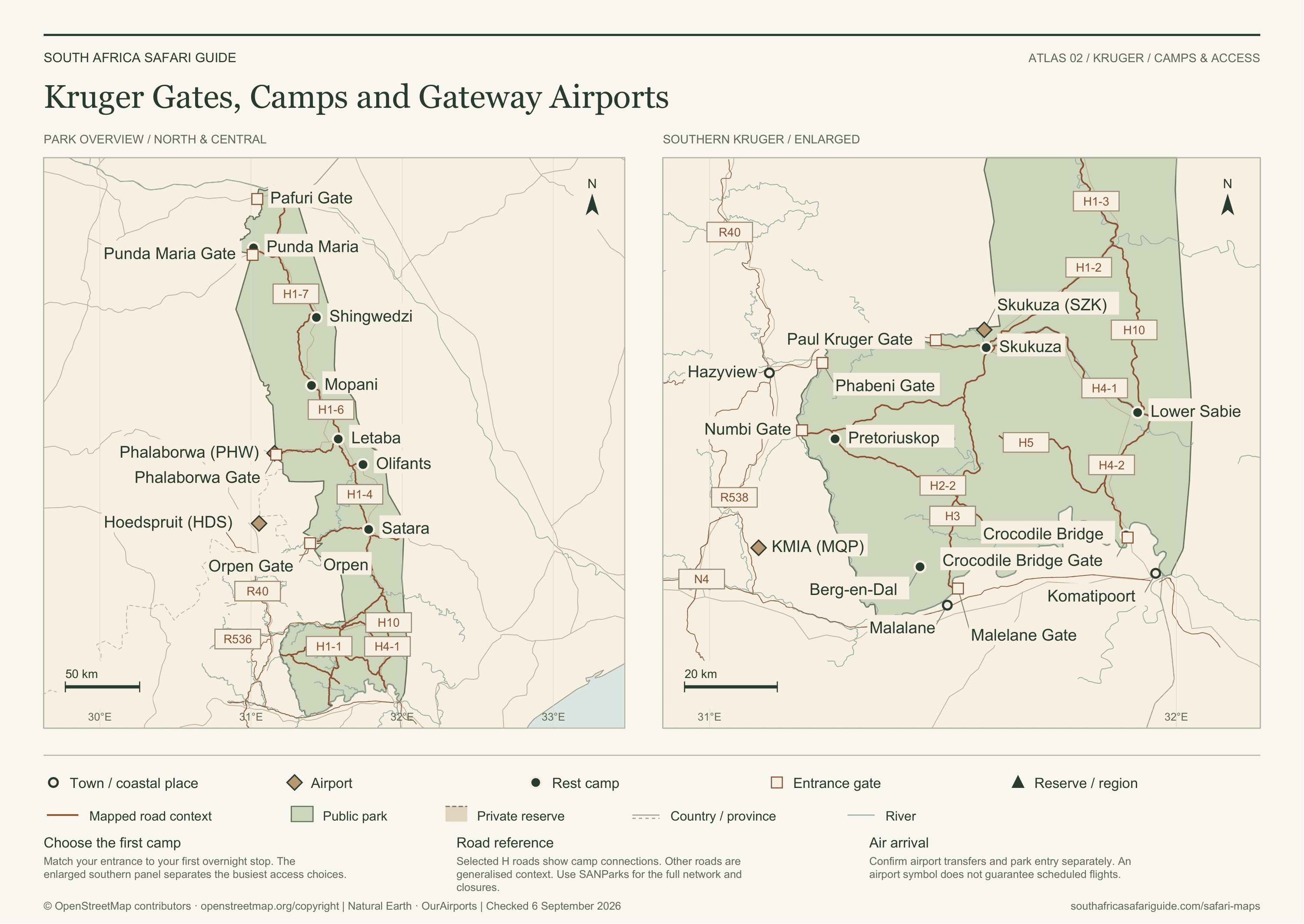
Geography: © OpenStreetMap contributors (ODbL); Natural Earth and OurAirports (public domain). Download source data.
Geographic sources checked . Generalised planning context; confirm current access before travelling.
Map sources and access references
- SANParks Kruger entrance gates — Official public gate names and operational guidance.
- SANParks Kruger maps — Official operational and camp-map directory; linked, not reproduced.
- SANParks Kruger GPS waypoints — Official camp waypoint verification.
- SANParks Kruger travel times — Official travel-time cautions and planning context.
- Natural Earth — Public-domain country, province, river, road and city context.
- OurAirports — Public-domain airport coordinates; symbols do not assert scheduled services.
Safari planning atlas
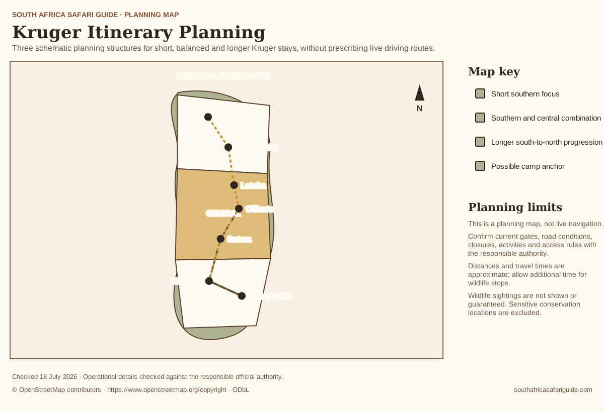
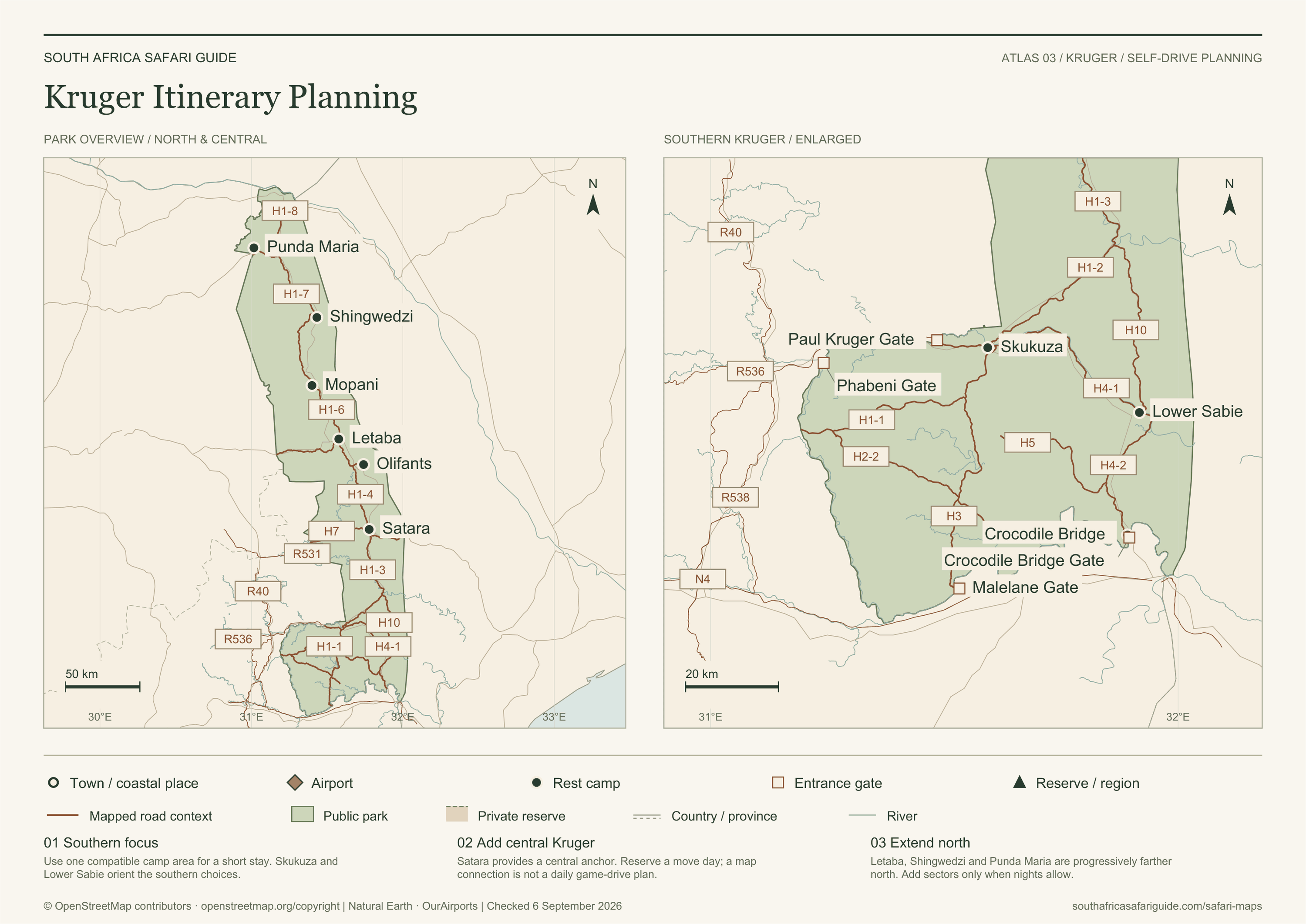
Kruger Itinerary Planning
A geographic overview and enlarged southern map for choosing compatible Kruger camp anchors and a realistic north-to-south trip structure.
Map in words
- A short trip should remain in southern Kruger around one compatible camp area.
- A balanced stay may connect southern and central Kruger using two camp anchors.
- A longer progression can move from southern through central toward northern Kruger only when enough nights and realistic move days are available.
Geography: © OpenStreetMap contributors (ODbL); Natural Earth and OurAirports (public domain). Download source data.
Geographic sources checked . Generalised planning context; confirm current access before travelling.
Map sources and access references
- SANParks Kruger maps — Official operational and camp-map directory; linked, not reproduced.
- SANParks Kruger GPS waypoints — Official camp waypoint verification.
- SANParks Kruger travel times — Official travel-time cautions and planning context.
- Natural Earth — Public-domain country, province, river, road and city context.
- OurAirports — Public-domain airport coordinates; symbols do not assert scheduled services.
Safari planning atlas
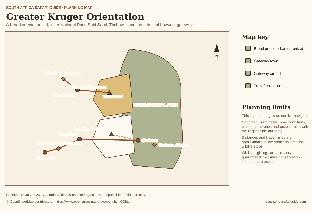
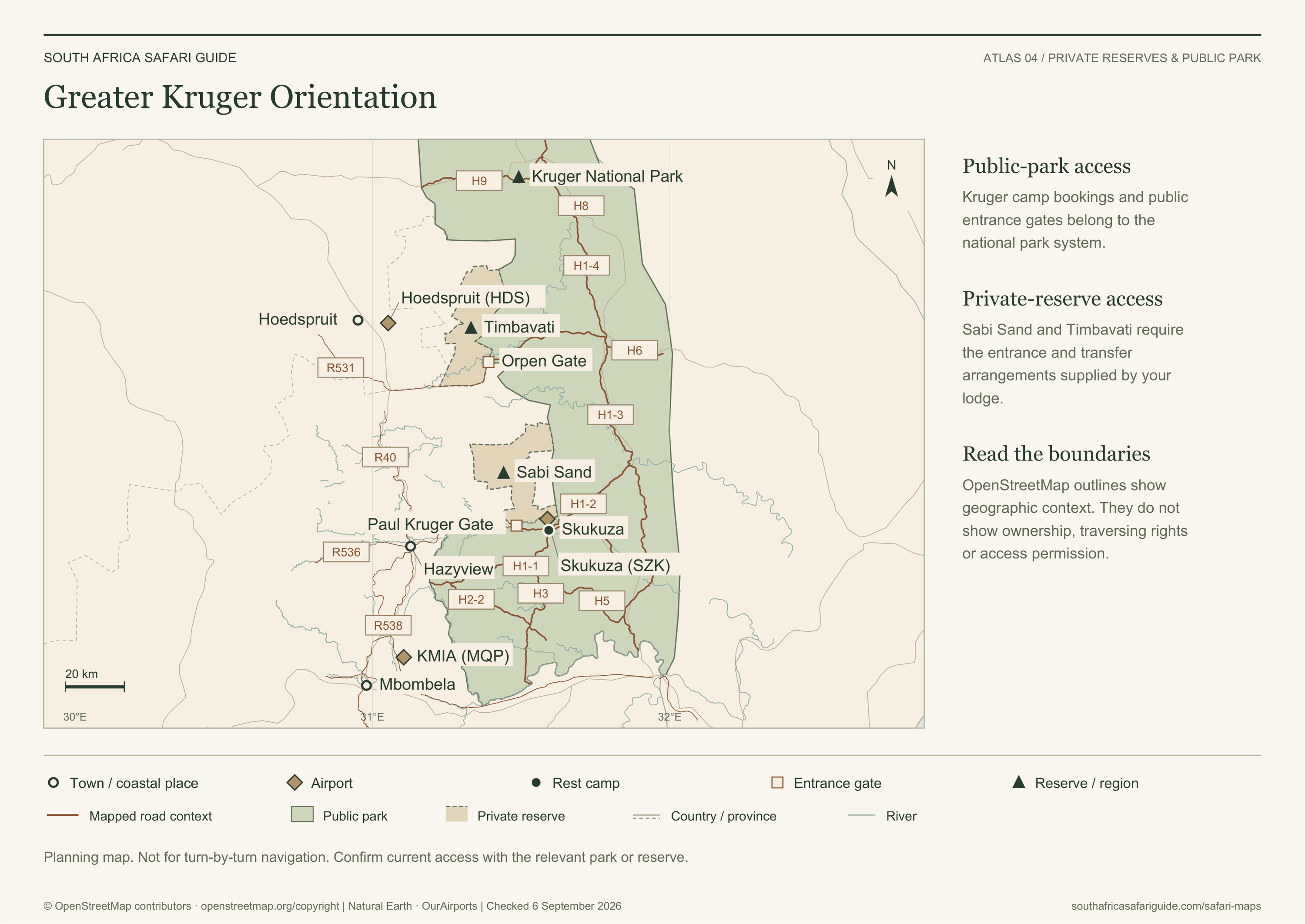
Greater Kruger Orientation
A broad orientation to Kruger National Park, Sabi Sand, Timbavati and the principal Lowveld gateways.
Map in words
- Kruger National Park forms the large eastern public-park context.
- Sabi Sand and Timbavati lie west of Kruger. Mapped outlines provide geographic context, not lodge ownership or traversing rights.
- Mbombela and Hazyview support southern access, while Hoedspruit supports central Greater Kruger access. Skukuza sits within southern Kruger.
Geography: © OpenStreetMap contributors (ODbL); Natural Earth and OurAirports (public domain). Download source data.
Geographic sources checked . Generalised planning context; confirm current access before travelling.
Map sources and access references
- SANParks Kruger National Park — Current park overview and principal public camp context.
- SANParks Kruger maps — Official operational and camp-map directory; linked, not reproduced.
- Natural Earth — Public-domain country, province, river, road and city context.
- OurAirports — Public-domain airport coordinates; symbols do not assert scheduled services.
- Sabi Sand official access — Reserve-specific entrances and lodge access arrangements.
- Timbavati Nature Reserve — Official reserve and visitor context.
Safari planning atlas
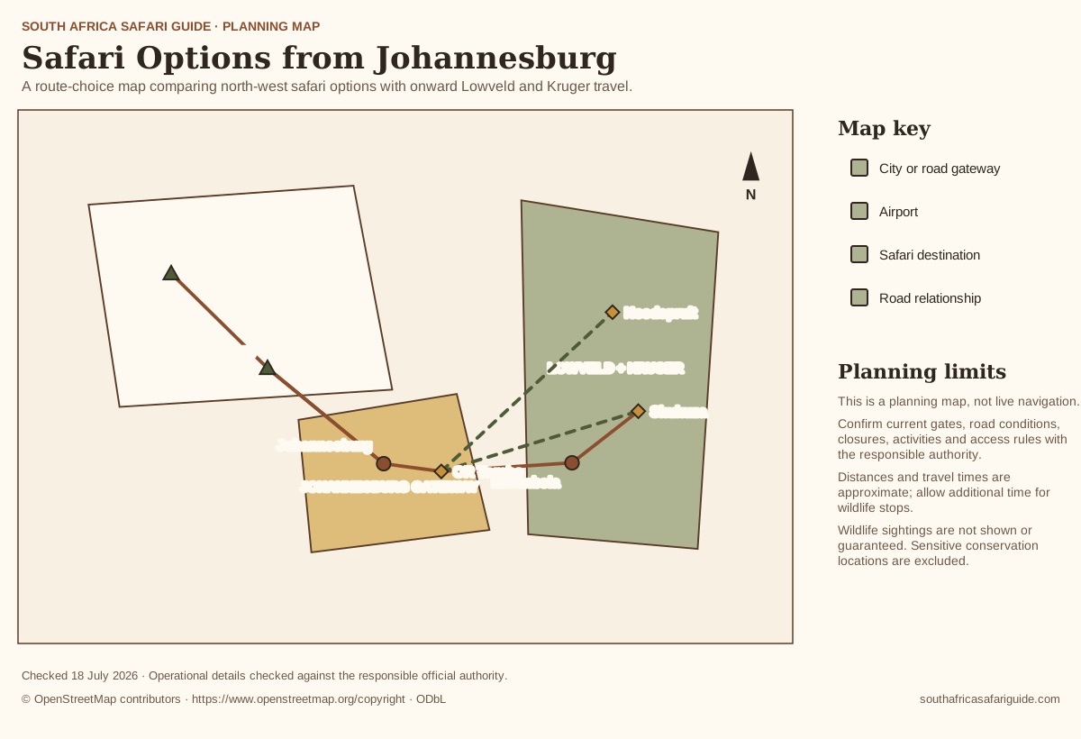
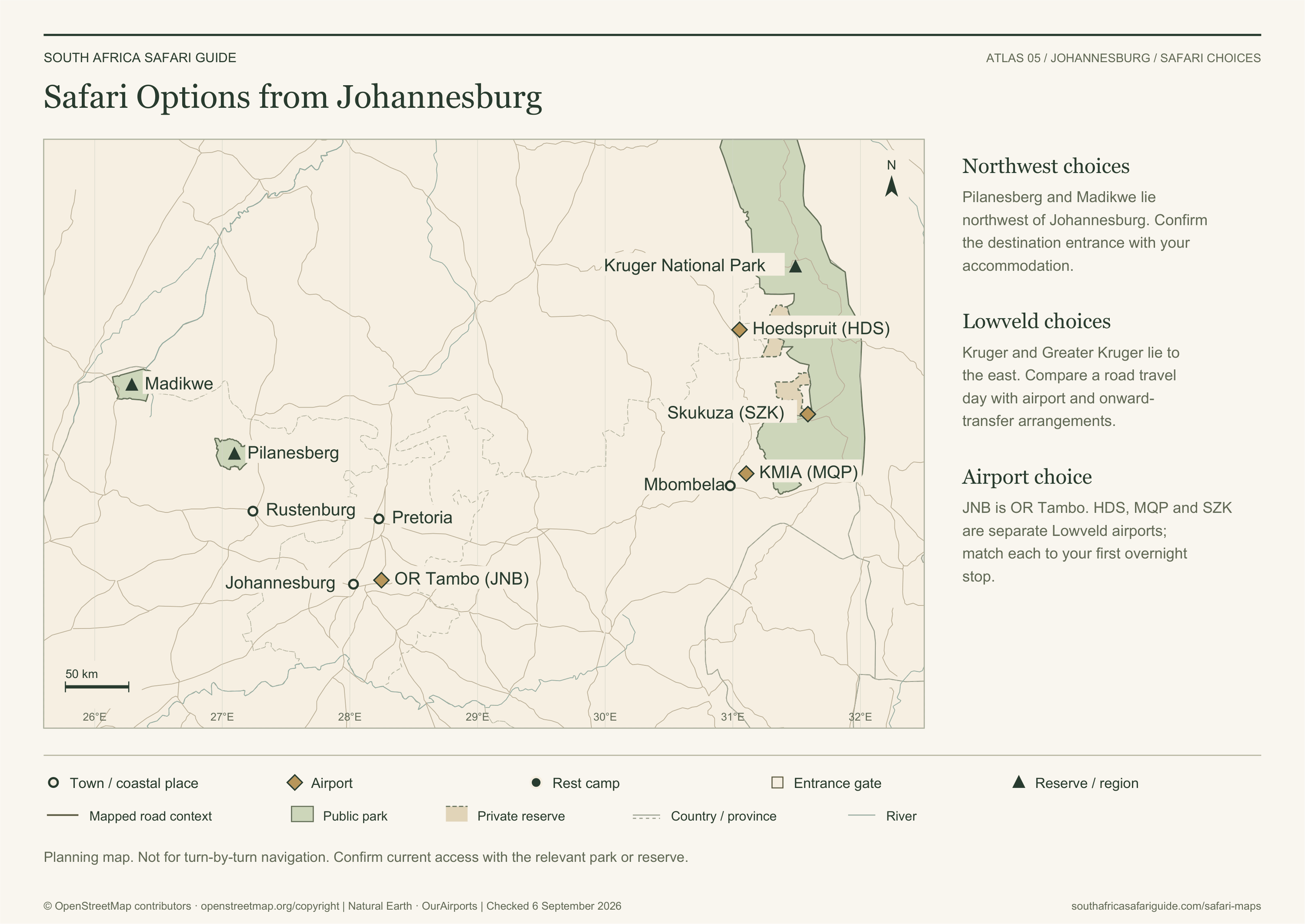
Safari Options from Johannesburg
A route-choice map comparing north-west safari options with onward Lowveld and Kruger travel.
Map in words
- Pilanesberg lies northwest of Johannesburg and is the shorter road-access relationship shown.
- Madikwe lies farther northwest and is presented as a lodge-based destination requiring confirmed transfer planning.
- Kruger and Greater Kruger lie east of Johannesburg, reached by longer road travel or flights through Mbombela, Skukuza or Hoedspruit gateways.
Geography: © OpenStreetMap contributors (ODbL); Natural Earth and OurAirports (public domain). Download source data.
Geographic sources checked . Generalised planning context; confirm current access before travelling.
Map sources and access references
- SANParks Kruger entrance gates — Official public gate names and operational guidance.
- SANParks Kruger travel times — Official travel-time cautions and planning context.
- Natural Earth — Public-domain country, province, river, road and city context.
- OurAirports — Public-domain airport coordinates; symbols do not assert scheduled services.
- Madikwe official reserve information — Lodge-based reserve access; confirm arrangements with your host.
- North West Parks Board — Responsible provincial park authority.
Safari planning atlas
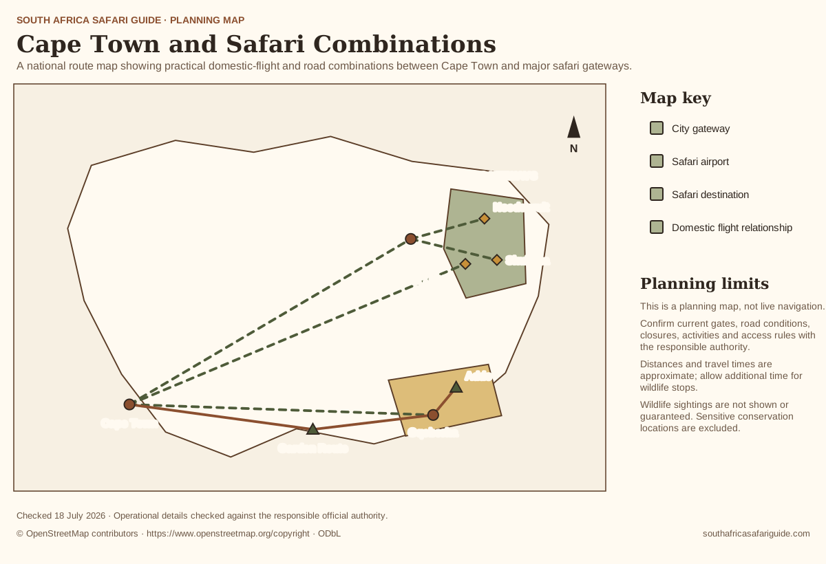
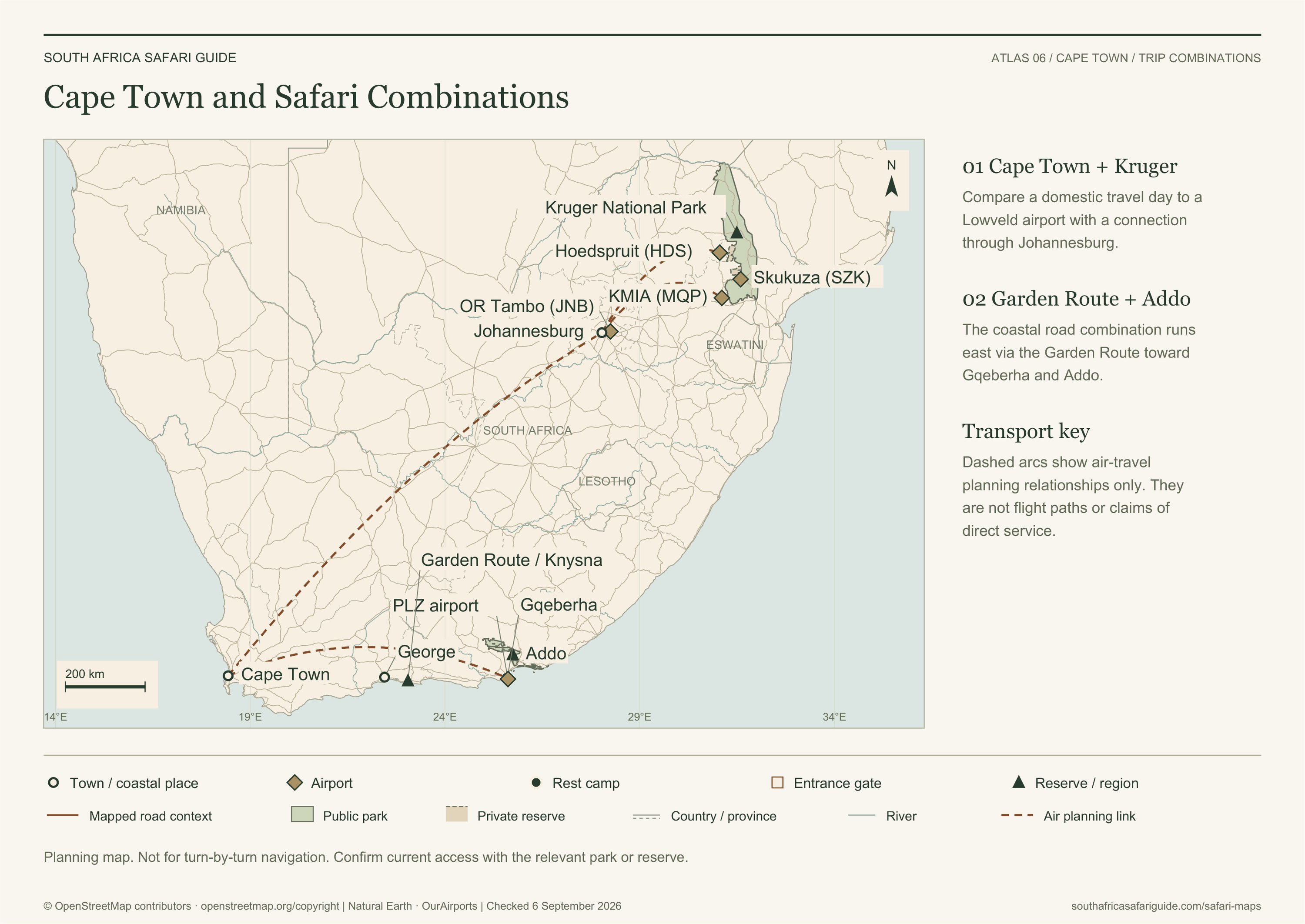
Cape Town and Safari Combinations
A national route map showing practical domestic-flight and road combinations between Cape Town and major safari gateways.
Map in words
- Cape Town can connect through Johannesburg or current domestic services to Lowveld gateways including Mbombela, Skukuza and Hoedspruit.
- Cape Town can also connect east by road through the Garden Route or by domestic flight to Gqeberha for Addo and Eastern Cape safari planning.
- Every combination requires a protected domestic travel day and separately confirmed airport-to-park or airport-to-lodge transfer.
Geography: © OpenStreetMap contributors (ODbL); Natural Earth and OurAirports (public domain). Download source data.
Geographic sources checked . Generalised planning context; confirm current access before travelling.
Map sources and access references
- SANParks Kruger travel times — Official travel-time cautions and planning context.
- SANParks Addo access — Official access and gateway context.
- SANParks Addo maps — Official Addo visitor-map directory; linked, not reproduced.
- Natural Earth — Public-domain country, province, river, road and city context.
- OurAirports — Public-domain airport coordinates; symbols do not assert scheduled services.
Safari planning atlas
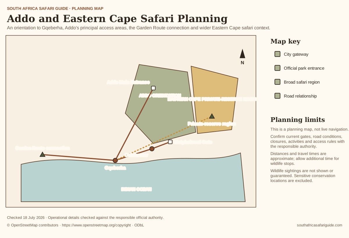
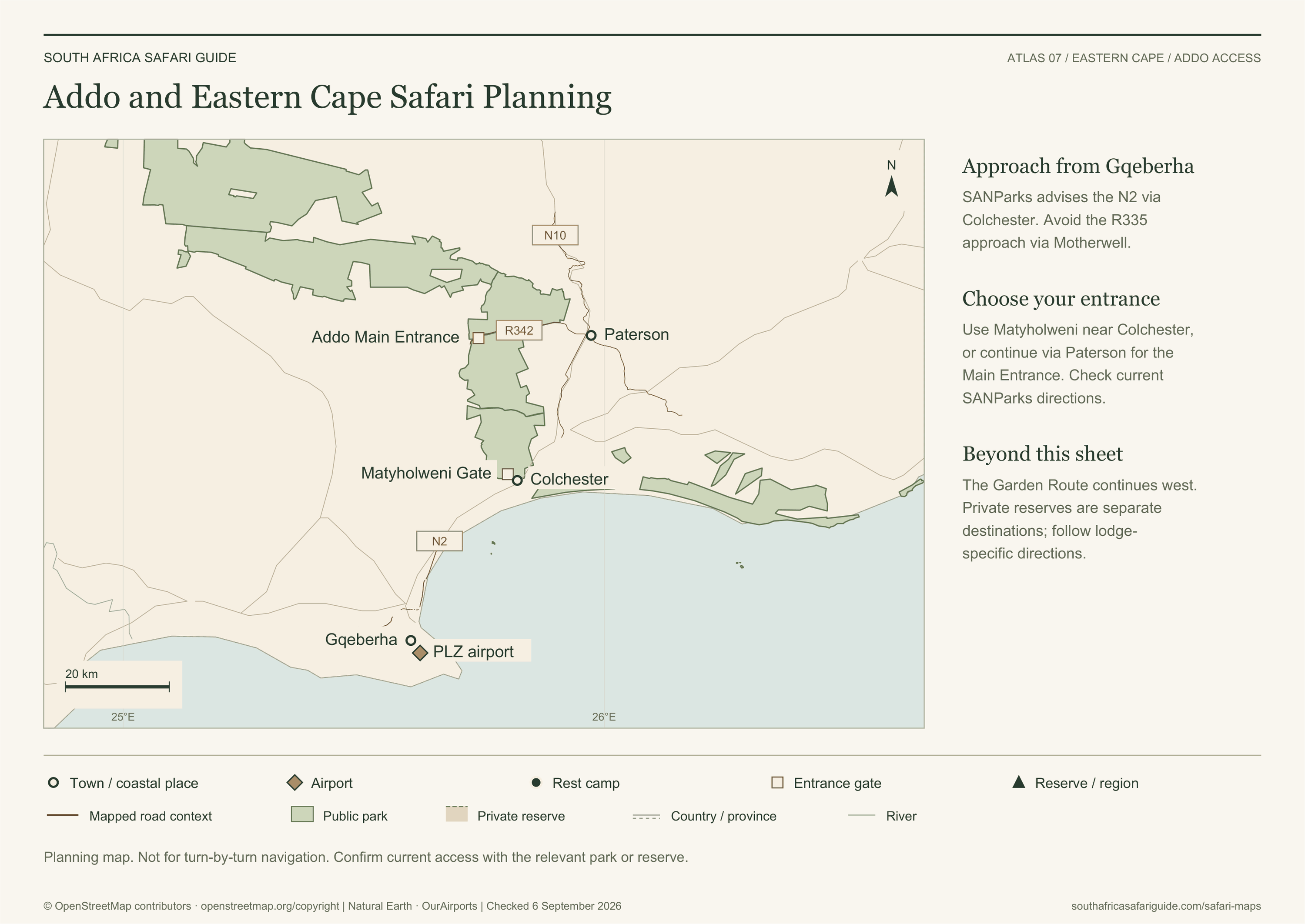
Addo and Eastern Cape Safari Planning
An orientation to Gqeberha, Addo's principal access areas, the Garden Route connection and wider Eastern Cape safari context.
Map in words
- Gqeberha is the city and airport gateway south of Addo.
- SANParks advises the N2 approach via Colchester, entering at Matyholweni or continuing via Paterson to the Main Entrance. Avoid the R335 approach via Motherwell.
- The Garden Route continues west beyond this sheet. Private reserves require lodge-specific directions.
Geography: © OpenStreetMap contributors (ODbL); Natural Earth and OurAirports (public domain). Download source data.
Geographic sources checked . Generalised planning context; confirm current access before travelling.
Map sources and access references
- SANParks Addo maps — Official Addo visitor-map directory; linked, not reproduced.
- SANParks Addo access — Official access and gateway context.
- SANParks Addo entrance gates — Official Main Entrance and Matyholweni gate information.
- Natural Earth — Public-domain country, province, river, road and city context.
- OurAirports — Public-domain airport coordinates; symbols do not assert scheduled services.
Safari planning atlas
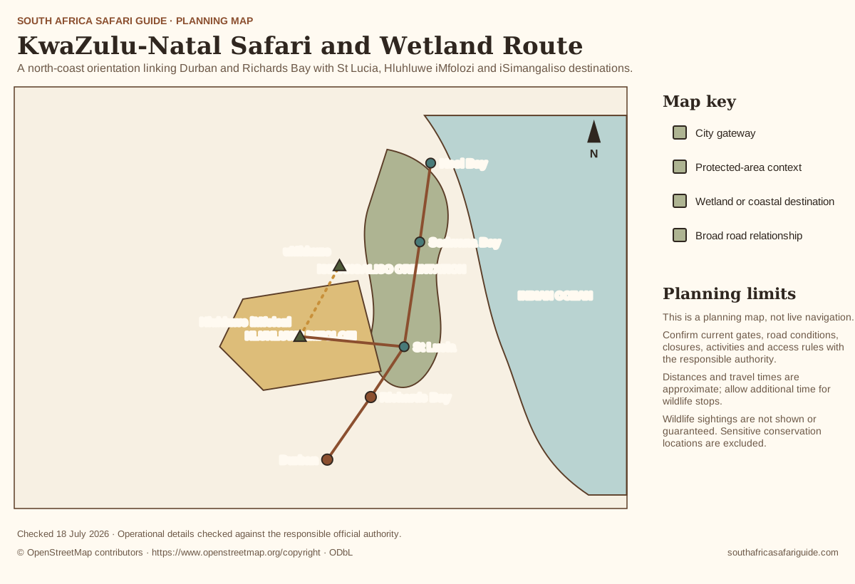
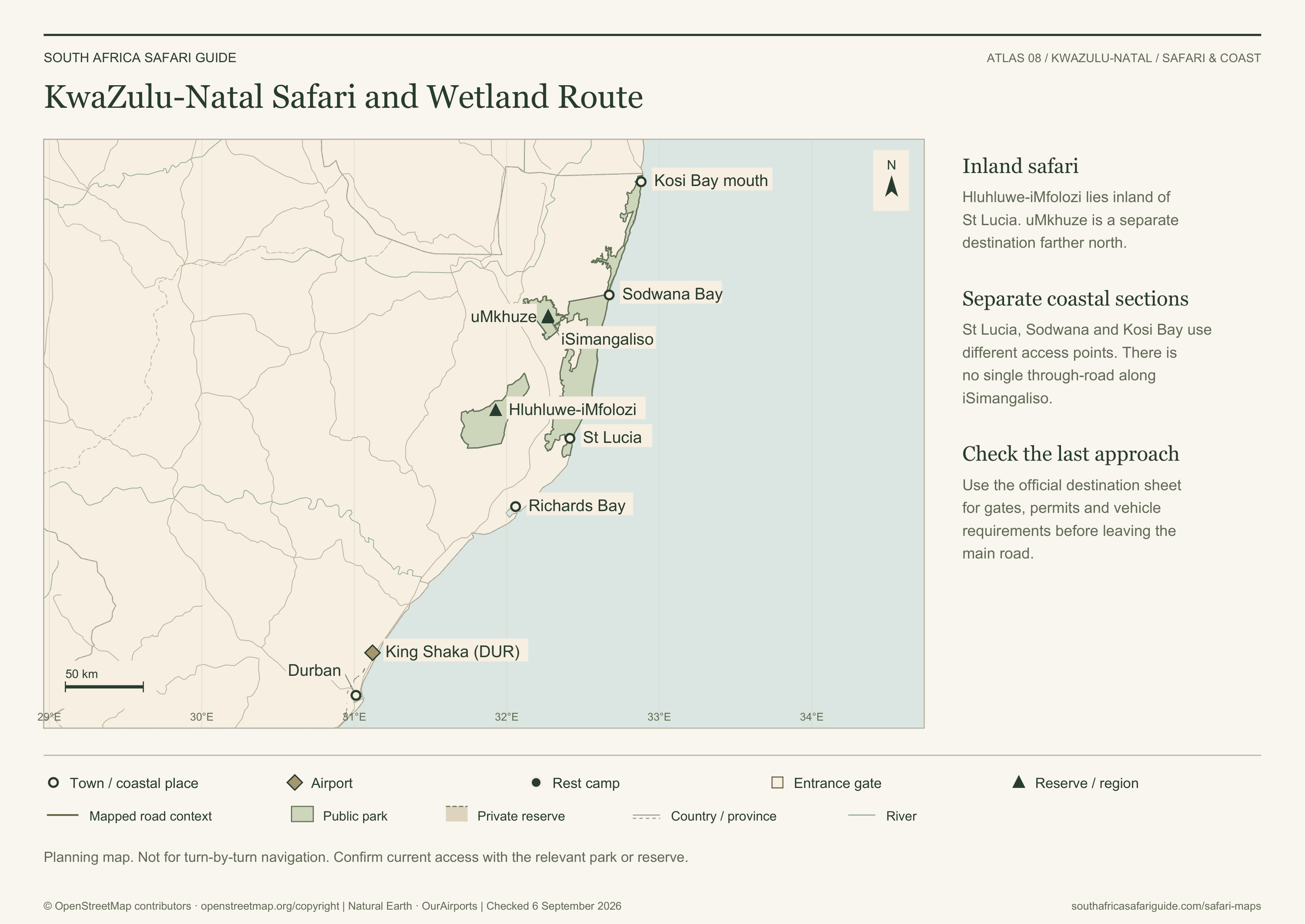
KwaZulu-Natal Safari and Wetland Route
A north-coast orientation linking Durban and Richards Bay with St Lucia, Hluhluwe iMfolozi and iSimangaliso destinations.
Map in words
- The route progresses north from Durban through Richards Bay toward St Lucia.
- Hluhluwe iMfolozi lies inland from the St Lucia and iSimangaliso coastal context.
- uMkhuze, Sodwana Bay and Kosi Bay are separate northern destinations. iSimangaliso has no single through-road; use official destination maps for access.
Geography: © OpenStreetMap contributors (ODbL); Natural Earth and OurAirports (public domain). Download source data.
Geographic sources checked . Generalised planning context; confirm current access before travelling.
Map sources and access references
- iSimangaliso official maps — Official map directory for St Lucia, Sodwana Bay, Kosi Bay and uMkhuze.
- Ezemvelo KZN Wildlife parks — Responsible authority context for KwaZulu-Natal protected areas.
- Natural Earth — Public-domain country, province, river, road and city context.
- OurAirports — Public-domain airport coordinates; symbols do not assert scheduled services.