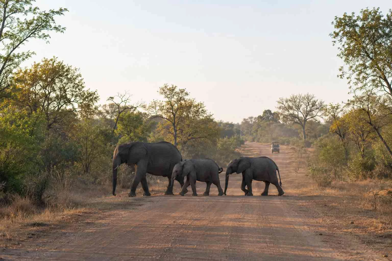
An elephant herd crossing a gravel road in Kruger National Park.

Kruger planning hub

Kruger National Park Planning Hub

Use this route index to choose a Kruger safari style first, then resolve gates, camps, travel times, itinerary length, packing and health preparation. It directs planning questions to specialist guides instead of repeating their detail.

Planning map

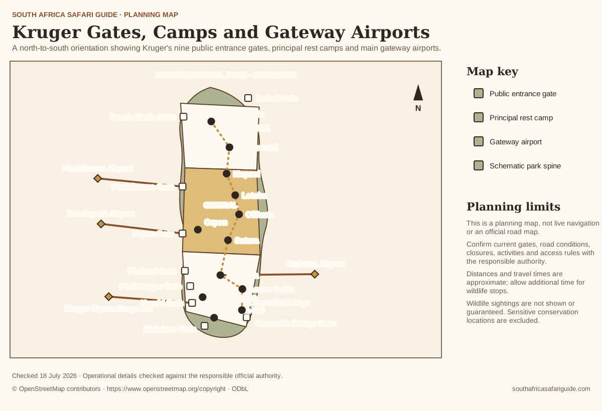
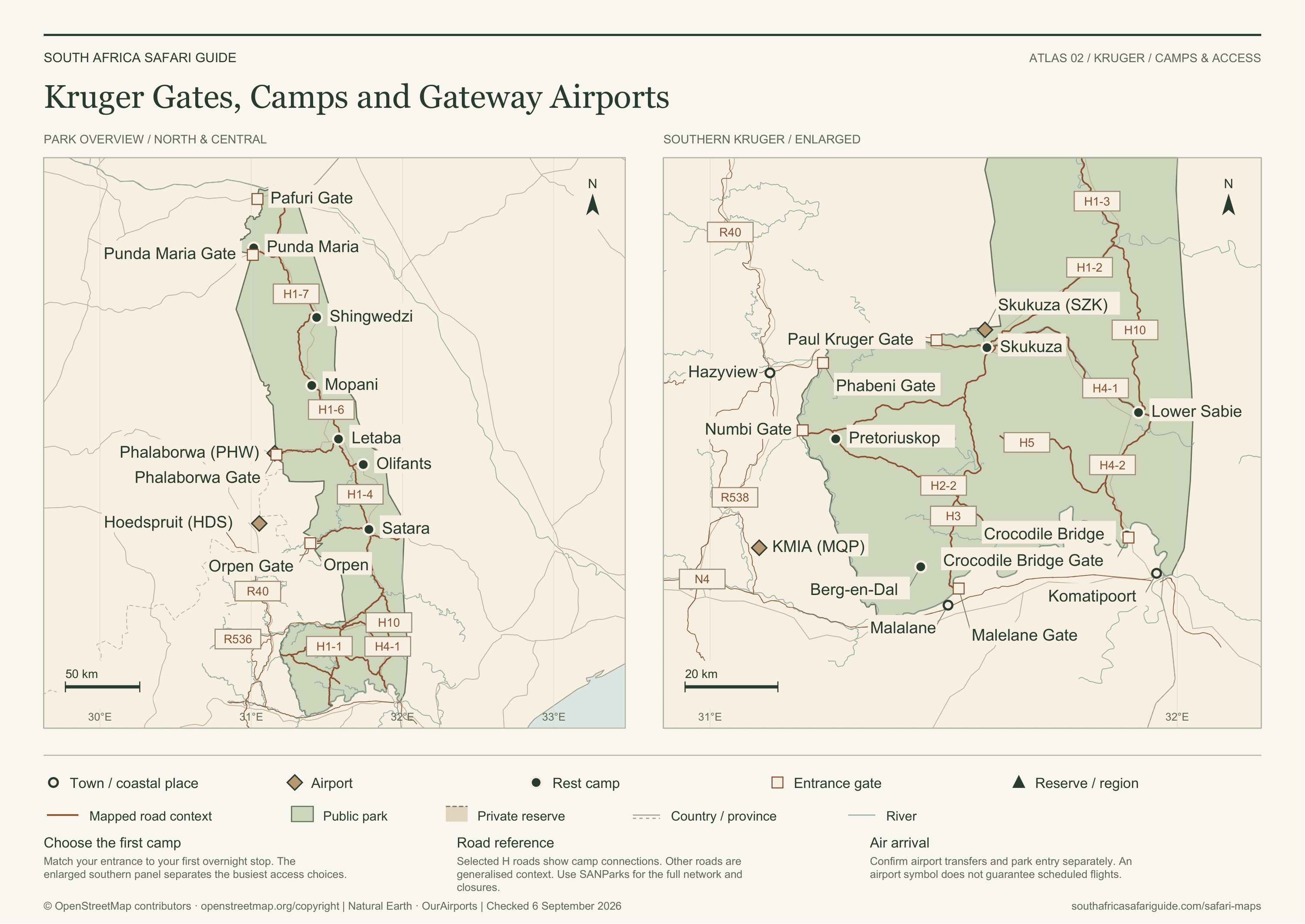
Kruger Gates, Camps and Gateway Airports

A north-to-south orientation showing Kruger's nine public entrance gates, principal rest camps and main gateway airports.

Kruger Gates, Camps and Gateway AirportsA north-to-south orientation showing Kruger's nine public entrance gates, principal rest camps and main gateway airports. Match an arrival gateway to a realistic park sector and first camp without implying road access or travel-time guarantees.KRUGER NATIONAL PARK - SCHEMATICNORTHERNCENTRALSOUTHERNPafuri GatePunda Maria GatePhalaborwa GateOrpen GatePhabeni GatePaul Kruger GateNumbi GateMalelane GateCrocodile Bridge GatePunda MariaShingwedziMopaniLetabaOlifantsSataraOrpenSkukuzaPretoriuskopLower SabieBerg-en-DalCrocodile BridgePhalaborwa AirportHoedspruit AirportSkukuza AirportKruger Mpumalanga Intl© OpenStreetMap contributors · openstreetmap.org/copyright

Map in words

  • Northern Kruger is oriented around Pafuri and Punda Maria gates, with Punda Maria and Shingwedzi as principal camp anchors.
  • Central Kruger includes Phalaborwa and Orpen gates, with Mopani, Letaba, Olifants, Satara and Orpen camps.
  • Southern Kruger includes Phabeni, Paul Kruger, Numbi, Malelane and Crocodile Bridge gates, with Skukuza, Pretoriuskop, Lower Sabie, Berg-en-Dal and Crocodile Bridge camps.
  • Gateway airports shown are Phalaborwa, Hoedspruit, Skukuza and Kruger Mpumalanga International.

Map data and place relationships from © OpenStreetMap contributors. Open map data is available under the Open Database License (ODbL).

Operational labels checked against the responsible official sources on . The authorities and OpenStreetMap do not endorse this guide.

Planning map

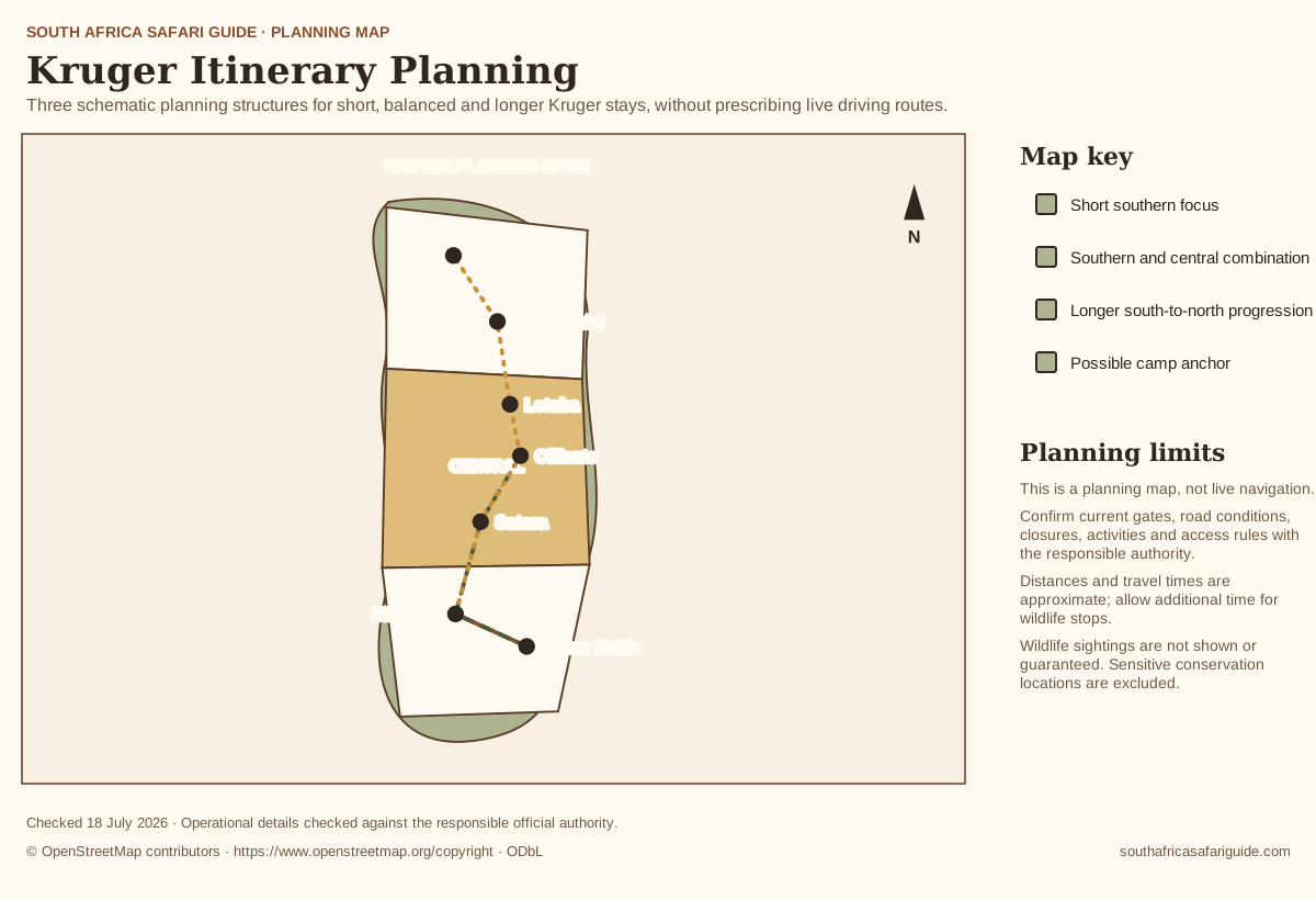
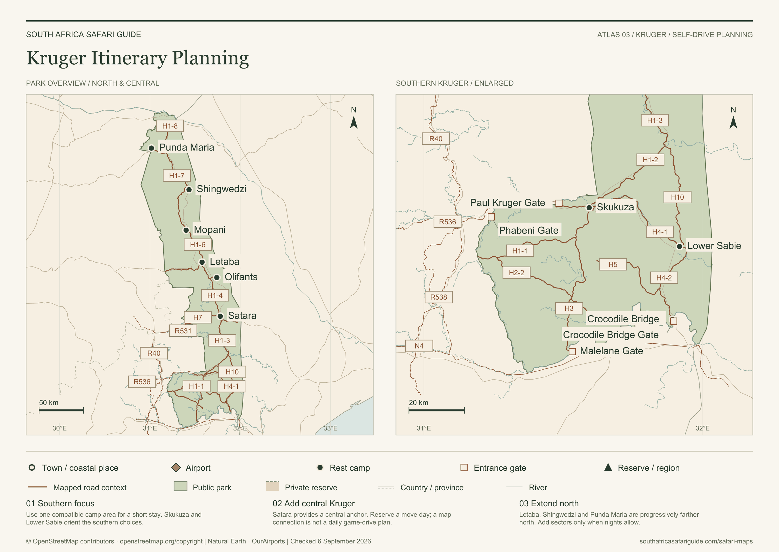
Kruger Itinerary Planning

Three schematic planning structures for short, balanced and longer Kruger stays, without prescribing live driving routes.

Kruger Itinerary PlanningThree schematic planning structures for short, balanced and longer Kruger stays, without prescribing live driving routes. Visualise how one, two or three compatible park sectors can structure a stay while preserving wildlife time.KRUGER PLANNING SPINENORTHERNCENTRALSOUTHERNPunda MariaShingwedziLetabaOlifantsSataraSkukuzaLower Sabie© OpenStreetMap contributors · openstreetmap.org/copyright

Map in words

  • A short trip should remain in southern Kruger around one compatible camp area.
  • A balanced stay may connect southern and central Kruger using two camp anchors.
  • A longer progression can move from southern through central toward northern Kruger only when enough nights and realistic move days are available.

Map data and place relationships from © OpenStreetMap contributors. Open map data is available under the Open Database License (ODbL).

Operational labels checked against the responsible official sources on . The authorities and OpenStreetMap do not endorse this guide.

Start with access

Plan your journey before you choose the prettiest camp

Kruger rewards visitors who plan from the outside in. Your first decisions are arrival route, entrance gate, daylight, conservation fees, gate closing discipline and the distance from gate to camp. A camp that looks perfect can become stressful if the first day asks too much of tired travellers.

SANParks information should be treated as the operational source for gate hours, travel times, notices, fees and park rules. This hub points you to editorial guidance first, then to the official page where current details must be confirmed before booking.

Booking options

Compare multi-day Kruger tours

Compare multi-day Kruger tours

Organised tours vary in gateway, accommodation, route, game-drive time, transfers and whether they visit the public park, nearby private reserves or both.